
Vista Drop
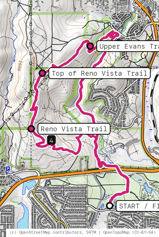
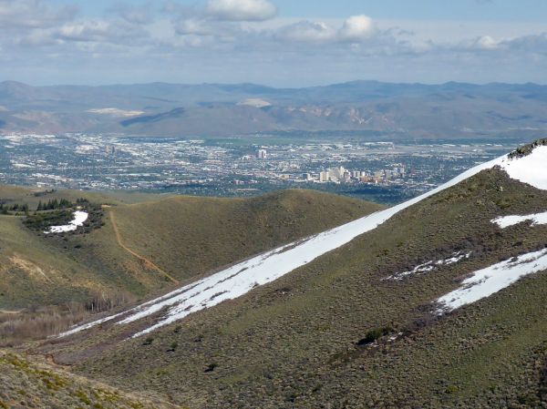
Climb Evans Canyon, traverse Upper Evans across the hill, then let the rebuilt Reno Vista Trail carry you back down with the whole valley in front of you.
Your timesno timed runs yet
Ride mode times every run on its own: the clock starts when you roll out of the start and stops at the finish, with splits at each marked spot. Leave Ride mode on between laps and it re-arms when you're back at the start. Times stay on this phone.
Right now at the trailhead


Get the GPS file
Scan with a friend's phone, or tap below. Then open it in your ride app.
- iPhone: tap Download, open it from the Downloads bar, then Share → Trailforks, Strava or Garmin.
- Android: tap Download, then open the file and pick your app.
- Garmin: or drag it into Garmin Connect → Courses → Import on a computer.
https://bsqrd-designs.com/dirt/vista-drop/
Getting there
Park at Rancho San Rafael Regional Park, west lot
San Rafael Dr off Putnam Dr, Reno, NV 89503
- Washoe County regional park lot at the west end of the park, south of North McCarran Blvd. Under 1 mile from the UNR campus (straight-line distance measured on the map).
- Start and finish are the same spot. Follow the cue sheet and the arrows on the map.
Cue sheet
| 0.0 | Streetpavement | 0.2 mi |
| 0.2 | Dirt roaddirt road | 0.5 mi |
| 0.7 | Evans Canyon Trailsingletrack | 1.6 mi |
| 2.3 | Upper Evans Trailsingletrack | 1.0 mi |
| 3.3 | Reno Vista Traildirt road via Top of Reno Vista Trail | 1.5 mi |
| 4.8 | Singletrack connectorsingletrack | 0.4 mi |
| 5.2 | Evans Canyon Trailsingletrack | 0.5 mi |
| 5.7 | Dirt roaddirt road | 0.5 mi |
| 6.1 | Back at Rancho San Rafael Regional Park, west lot |
Know before you go
- Closed right now: the Hawk Fire closure (Humboldt-Toiyabe National Forest order 04-17-26-01-06) shuts the Upper Evans Trail, the national forest stretch this ride needs to reach Reno Vista until 12:01 on Oct 31, 2026, unless the Forest lifts it sooner. Check the Forest's alerts page before you go, and once it reopens expect burn damage, loose soil and missing signs.
- Upper Evans is the crux: a semi-technical traverse with a few rocky lines. Most have ride-arounds; walk anything that looks wrong.
- Reno Vista was rebuilt as a beginner-to-intermediate flow descent with berms, rollers and optional jumps and drops. It is ridden downhill only on this loop. Do not climb it.
- While the closure is on, Canyon Commute rides the open Evans Canyon and Miners trails from the same lot.
Ride smart
- Water: plan on about 1 L for this ride. There's none on the trail.
- Signal is spotty. Tell someone your route and your time back.
- Emergency: call 911 and say "Vista Drop ride, parked at Rancho San Rafael Regional Park, west lot, Reno, Nevada", plus the coordinates from Locate me.
- Wildlife: give horses, burros and anything with horns room, and never feed them.
- Stay on trail. Desert crust and mountain soil take decades to heal.
Report a problem or share a photo
Washout, closure, new fence or a missing sign? Got a great shot of a junction? Send it. It goes straight to Ryan; photos he approves show up on this page with your credit.
End ride?
Turn calls, the timer and your recording stop when the ride ends.